

The Core Principle: Satellites, Radio Signals, and Timing
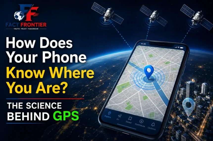
Understanding how phone GPS works begins the moment you open a navigation app and see that familiar blue dot pinpoint your exact location. Whether you are walking through a busy city street or driving on a highway, your smartphone seems to instantly know where you are. But behind that simple visual is a sophisticated network of space technology, precise timing signals, and advanced mathematical calculations happening in real time.
Open a map app on your phone and, within seconds, a small blue dot usually appears to show your location. You may be standing on a busy street, sitting inside a car, or walking through an unfamiliar neighbourhood, yet your phone can often tell you where you are with surprising accuracy.
It seems simple because the result is simple.
But finding a location on Earth is not a simple problem.
Your phone does not have a tiny map inside it that somehow knows where you are. It also does not need a satellite to look down and identify you. Instead, it receives signals, measures incredibly small time differences, and uses mathematics to calculate its position.
That is the basic idea behind GPS, or the Global Positioning System.
And there is an important detail that many people miss: GPS satellites do not normally tell your phone, “You are here.” Your phone receives their signals and works out its location from them.
GPS starts with satellites
GPS depends on a network of satellites orbiting Earth.
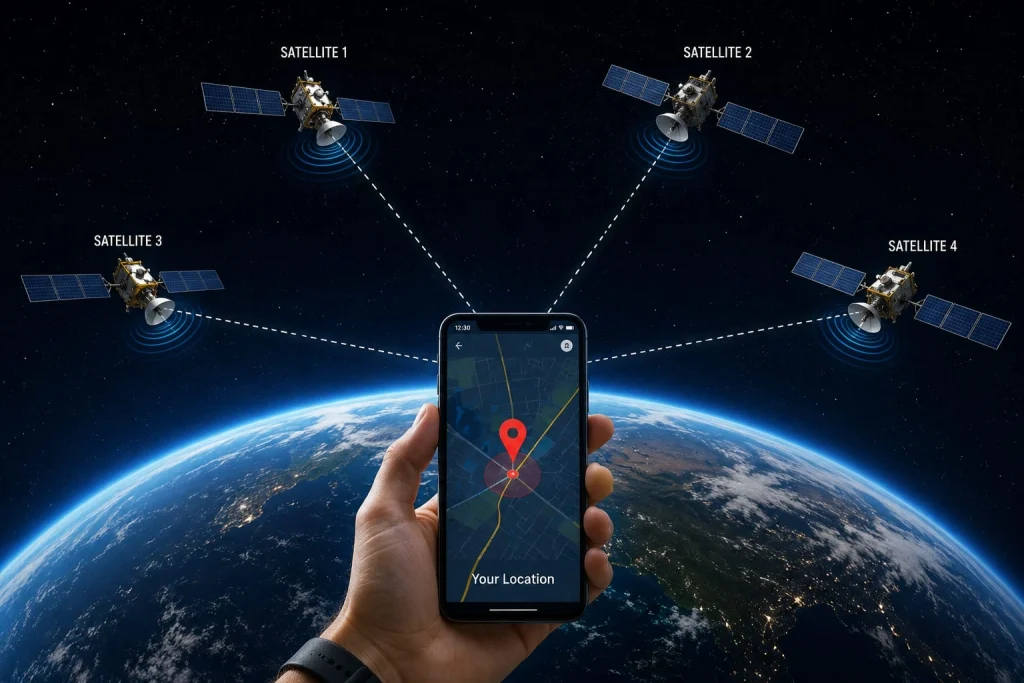
These satellites continuously transmit radio signals containing information about their position and the precise time at which each signal was sent. A GPS receiver in your phone picks up these signals and compares the information coming from different satellites.
Radio signals travel through space at roughly the speed of light. That makes timing extremely important.
If your phone knows when a signal left a satellite and when it arrived, it can estimate how far the satellite is from the phone.
The difference may be incredibly small, but GPS is designed to work with measurements at that level.
Once the phone has distance information from several satellites, it can begin working out its position.
One satellite is not enough.
Imagine you are somewhere in a large city, and someone tells you that you are exactly 10 kilometres from a particular landmark.
That information does not tell you exactly where you are. You could be anywhere along a large circle surrounding that landmark.
Now suppose you are also told your distance from a second landmark. The possible locations become much more limited.
Add a third reference point and the location can be narrowed down further.
GPS uses the same basic principle, although the mathematics is much more sophisticated and the reference points are satellites moving around Earth.
This process is known as trilateration.
GPS measures distances rather than angles. That is why the term trilateration is more accurate than the commonly used word “triangulation.”
“That is the basic idea behind GPS, or the Global Positioning System, operated as a public utility.”
Why does GPS usually need four satellites?
Three satellites can provide enough information to estimate a position in three dimensions, but there is another problem: time.
GPS determines distance by measuring how long a signal takes to travel from a satellite to your phone. That means the phone needs an extremely accurate clock.
Your smartphone does not carry an atomic clock as the satellites do.
Even a very small error in the phone’s clock can produce a significant error in the calculated distance. That uncertainty has to be corrected along with the phone’s position.
The fourth satellite provides the additional information needed to solve for the clock error.
In simplified terms, the receiver is trying to determine four things at once:
- its position in three dimensions
- the error in its own clock
With signals from several satellites, the receiver can solve these unknowns and arrive at a location.
This is one of the reasons GPS is such an impressive engineering system. The phone is not simply reading a location from a satellite. It is solving a mathematical problem using signals that have travelled through space.
GPS and Google Maps are not the same thing
People often use the terms GPS and Google Maps as though they mean the same thing, but they do different jobs.
GPS determines or helps determine your position.
Google Maps displays that position and provides mapping, directions, and other location-based services.
Your phone can use GPS without Google Maps, and Google Maps can use several other sources of information to improve the location shown on the screen.
For example, smartphones can combine satellite positioning with:
- Wi-Fi networks
- mobile network information
- Bluetooth signals
- motion sensors
- digital maps
This is particularly useful when satellite signals are weak.
If you are inside a large building, surrounded by tall structures or underground, your phone may have difficulty receiving reliable GPS signals. Other positioning methods can help fill the gaps.
That is why the blue dot on your screen may sometimes be the result of several systems working together rather than GPS alone.
Why isn’t your location always perfect?
GPS can be remarkably accurate, but it is not flawless.
One of the biggest challenges comes from buildings.
In a city filled with tall structures, satellite signals can be blocked, weakened, or reflected by surfaces before reaching your phone. When a signal takes an indirect path, the receiver may calculate the distance incorrectly.
This effect is particularly noticeable in dense urban areas.
Indoor environments create another problem. GPS signals arriving from satellites are already relatively weak by the time they reach Earth. Passing through concrete walls, roofs and other structures can reduce their strength even further.
The atmosphere also affects radio signals as they travel toward Earth. GPS systems account for many of these effects, but small errors can remain.
Your phone therefore doesn’t simply calculate a location once and assume it must be correct. Modern devices combine different sources of information to improve the estimate.
GPS satellites are not taking pictures of you
There is a common misconception that GPS works because satellites are watching people from space.
That is not how the system works.
GPS satellites transmit radio signals. They do not need a camera to identify your phone’s location.
Your phone’s GPS receiver listens to signals from the satellites and uses their timing and position information to calculate where it is.
In the basic GPS positioning process, the phone does not have to send its location back to the GPS satellites.
This distinction is important.
Your location can certainly be shared with apps and online services when you permit them or when a service requires location access. But that is a separate issue from how the GPS receiver itself calculates position.
GPS provides the positioning information; applications decide how that information is used.
GPS is really a timekeeping system too
The most fascinating part of GPS may not be the satellites themselves. It is the importance of time.
The receiver calculates distance from the travel time of radio signals. Since those signals move at the speed of light, even a tiny error in timing can translate into a noticeable error in distance.
That is why GPS satellites carry extremely accurate atomic clocks.
These clocks are far more precise than the ordinary clock inside your phone. The GPS uses their timing information to help the receiver determine both distance and clock error.
There is also another subtle effect involved.
According to Einstein’s theory of relativity, clocks do not all run at the same rate under different conditions of gravity and motion. GPS engineers have to account for these relativistic effects for the system to maintain its required accuracy.
Without these corrections, GPS errors would accumulate quickly enough to make the system unreliable for precise navigation.
So the next time your phone tells you where you are, there is a little bit of Einstein hiding behind that blue dot.
GPS is useful far beyond maps
Navigation is probably the most familiar use of GPS, but positioning and timing systems have become important in many other fields.
Aircraft and ships use satellite positioning for navigation. Farmers use it for precision agriculture. Surveyors use it to measure locations with high accuracy. Emergency services can use location information to assist with response operations.
GPS timing is also valuable.
Communication networks, financial systems, power infrastructure and other technologies can use highly accurate timing to keep different systems synchronised.
This is easy to overlook because none of these applications necessarily look like navigation. But knowing the precise time and position of something can be just as useful as knowing which road you are on.
GPS is part of a larger satellite-navigation world
GPS is operated by the United States, but it is not the only global satellite navigation system.
Other systems include Galileo operated by the European Union, GLONASS operated by Russia, and BeiDou operated by China. India also operates NavIC, its regional navigation system.
Modern smartphones can support multiple satellite-navigation systems. Using signals from more satellites can improve availability and, in many situations, help the device obtain a more reliable position.
So when your phone determines where you are, it may be drawing on a broader satellite-navigation environment rather than relying on a single system.
What actually happens when the blue dot appears?
The next time you open a map, consider what has happened before that blue dot appears.
Satellites are orbiting hundreds or thousands of kilometres above Earth. Each is transmitting carefully timed radio signals.
Your phone receives signals from several of them. It examines when those signals arrived, compares that information with the satellites’ known positions and estimates the distances involved.
It then uses mathematics to calculate its own position.
If necessary, the phone can combine that result with information from Wi-Fi networks, mobile towers, sensors and other sources. The final location is then passed to the mapping application, which places the familiar blue dot on the screen.
All of this can happen within seconds.
There is no satellite taking a photograph of you and placing a marker on a map. There is no single tower telling your phone exactly where it stands.
Instead, your phone is solving a surprisingly complicated problem using radio signals, precise clocks, satellite positions and mathematics.
A simple question with a complicated answer
“Where am I?” sounds like one of the easiest questions a phone could answer.
In reality, answering it requires technology operating across an enormous distance.
Satellites have to maintain accurate timing while travelling around Earth. Ground systems have to track and manage the network. Your phone has to detect extremely weak signals and process them accurately. Software then turns all of that information into a location that makes sense on a map.
The result is so familiar that we rarely stop to think about it.
A small blue dot appears on the screen, and we simply start walking in the right direction.
But behind that dot is one of the most remarkable combinations of space technology, precision timing, radio communication and mathematics ever put into everyday use.
Frequently Asked Questions (FAQs)
Q1: Do GPS satellites take photos or watch my phone from space?
No. GPS satellites do not have cameras to track people on the ground. They simply broadcast radio signals with the exact time and their position in orbit. Your phone receives these signals and calculates its own coordinates locally.
Q2: Why does my phone need signals from at least 4 satellites?
Three satellites pinpoint your position in 3D space (latitude, longitude, and altitude). The fourth satellite is necessary to correct the slight time difference between the atomic clocks in space and the standard quartz clock inside your smartphone.
Q3: Is GPS the same thing as Google Maps?
No. GPS is the underlying hardware and satellite network that calculates your geographic coordinates. Google Maps is an application that takes those coordinates and displays them visually over digital road maps and navigation routes.
Q4: Can my phone find my location without an active internet connection?
Yes. Built-in GPS receivers can pick up satellite signals and calculate coordinates without mobile data or Wi-Fi. However, downloading the visual map details, live traffic updates, or using Assisted GPS (A-GPS) to lock on faster requires an internet connection.
Q5: Why does the blue dot jump or lose accuracy inside buildings and tunnels?
Satellite radio signals are weak by the time they reach Earth. Solid concrete roofs, metal walls, and tall city skyscrapers block, weaken, or bounce these signals (multipath error), making it difficult for your receiver to calculate an exact distance.
Q6: Does my phone send any signal back to the satellites?
No. The GPS receiver in your phone is strictly a one-way listener. It receives radio waves from space but does not transmit any data back to the satellites.
Also Read: – The Internet Is Not Actually Wireless: Most of It Travels Under the Ocean
Why Do Computers Use Only 0 and 1? The Basics of Binary Code
📚 Verified Research Sources & Fact-Checking Citations
At FactFrontier, every claim is cross-referenced with primary scientific databases, institutional research archives, and verified historical records:
- Nature & Scientific American Archives: Peer-reviewed science and interdisciplinary research publications.
- Encyclopaedia Britannica & Academic Repositories: Verified historical and encyclopedic reference data.
- Global Scientific Fact-Checking Networks: Primary institutional datasets and peer-reviewed literature.